Poster: A snowHead
|
|
|
|
Obviously A snowHead isn't a real person
Obviously A snowHead isn't a real person
|
Toadman,
Fantastic! Well done! 
|
|

|
|
|
|
Well, the person's real but it's just a made up name, see?
Well, the person's real but it's just a made up name, see?
|
|
@Toadman, looks like a Rainbow tower there. Way to go.
|
|
|
|
|
|
You need to Login to know who's really who.
You need to Login to know who's really who.
|
|
@Toadman, looks like a Rainbow tower there. Way to go.
|
|
|
|
|
|
Anyway, snowHeads is much more fun if you do.
Anyway, snowHeads is much more fun if you do.
|
What's a rainbow tower? 
|
|
|
|
|
|
You'll need to Register first of course.
You'll need to Register first of course.
|
|
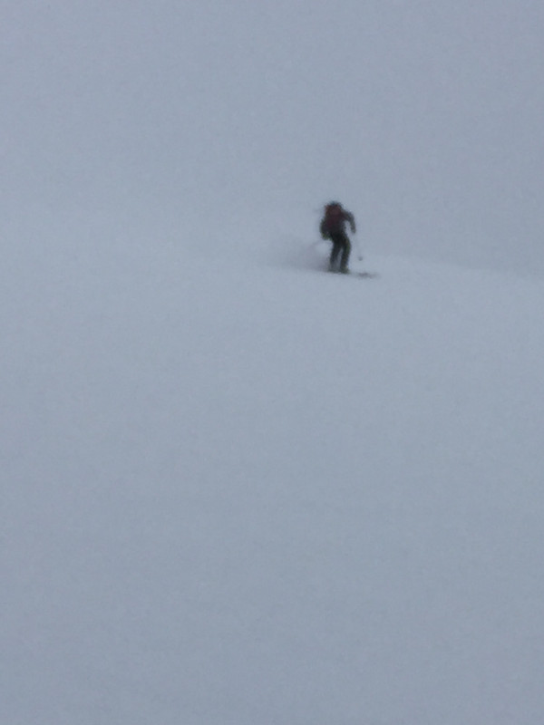
@Bergmeister, Rainbow chairlift. Good low angle terrain over there. (Oops, I see my earlier post twice, The signal where I am is so bad I’m surprised it worked at all)
|
|
|
|
|
|
|
|
|
|
|
|
|
|
Cold air up in British Columbia will favor the Eastern interior BC mountains. Montana and parts of Idaho should also see snow. Eastern Colorado Rockies should also see cooler than seasonal averages and some snow later in the week.
|
|
|
|
|
|
You'll get to see more forums and be part of the best ski club on the net.
You'll get to see more forums and be part of the best ski club on the net.
|
Quick hitting storm flowing through Colorado on Wed. into Thursday morning. Steamboat, Breck, Loveland, Winterpark , Keystone, Eldora should see a good 8"-10" of snow. Vail, Beaver Creek and Aspen maybe a bit less.
Out into the weekend, looks to be a cold front that will move in a SE direction through interior BC, Montana, the Tetons could possibly see some light snow accumulations.
Meanwhile, it's a bit warm and wet in the PNW. Temps will be above seasonal avg. through Friday, and then some of that cold air from Canada will make it's way South into WA and OR.
|
|
|
|
|
|
|
|
There's a high pressure building up along the West Coast just off of Washington. It's going to push some cold air coming down from NW Canada/Alaska into interior BC and down into Montana into Colorado on Saturday. Temps will be colder than normal, and potential for 12cm-20cm of snow in Summit County and Steamboat from Saturday night into Monday morning. A second wave of cold energy is following behind. Not as strong, or as big currently, but more potential accumulation of snow for base building.
Loveland, CO ski resort opened today.
Wolf Creek, CO announced an Oct. 31 opening (Halloween for us Yanks)
|
|
|
|
|
|
snowHeads are a friendly bunch.
snowHeads are a friendly bunch.
|
Cold temps and low pressure currently working it's way into Colorado. The main strength of the storm and precip will come later on Sunday evening into early Monday morning. Snow accumulation for the Summit County ski resorts could be upwards of 30cm. The higher elevations could see even more.
Vail is currently making snow and scheduling a Nov 15th opening.
|
|
|
|
|
|
And love to help out and answer questions and of course, read each other's snow reports.
And love to help out and answer questions and of course, read each other's snow reports.
|
Good start to the season.
Plenty of stations opening early.
And record snowfall in Montana and elsewhere, earlier in the month.
|
|
|
|
|
|
|
|
|
Several Colorado snow stakes showing anywhere from 6"-9" of snow, and still snowing. Cold air continues to push down from Northern Canada. Good snow making weather.
|
|
|
|
|
|
You know it makes sense.
|
Meanwhile in California everything is on fire* and we have no electricity*. No change in weather on the horizon - ~20 and sunny, every day for the next 10 days in SF and nothing happening in Tahoe.
* mild regionally dependent exaggerations
|
|
|
|
|
|
Otherwise you'll just go on seeing the one name:
Otherwise you'll just go on seeing the one name:
|
|
bump just to follow this thread. exciting stuff.
|
|
|
|
|
|
Poster: A snowHead
|
High pressure starting to build off the Northwest Pacific Coast. Should see mild temps and dry for the next 4-5 days. Cold air will still linger up over Eastern interior BC into Alberta.
Was talking to some folks in the transport dept. that mentioned trucks were sidelined on Interstate 84 going through Idaho. Same thing for truckers near Cheyenne, WY.
|
|
|
|
|
|
Obviously A snowHead isn't a real person
Obviously A snowHead isn't a real person
|
|
Jet stream is up North around the Canadian border. It will block colder air and moisture coming off the Pacific for the next 4-5 days, and possibly longer. Blocking HP is set up over Washington/Oregon and that will favor British Columbia and Alberta for potential snow fall possibly around Nov. 4-5th. New England is getting some cooler and wet weather this weekend as well.
|
|
|
|
|
|
Well, the person's real but it's just a made up name, see?
Well, the person's real but it's just a made up name, see?
|
| Toadman wrote: |
Wolf Creek, CO announced an Oct. 31 opening (Halloween for us Yanks) |
Err... and Halloween for us Brits as well. 
|
|
|
|
|
|
You need to Login to know who's really who.
You need to Login to know who's really who.
|
Jet Stream continues to be based up around the US/Canadian border, dropping down into the upper Mid-west and across the Great Lakes region into the New England states. Vermont/New Hampshire and Maine should see 6" plus of snow Monday night into Tuesday, and could be some record lows recorded as well.
The blocking HP over NW Coast of USA is starting to break down, and some storm energy looks to make its way into British Columbia and Northern Washington around Tuesday. Longer range forecast show that a series of weak storms coming off the Pacific will split and bring a bit of energy on shore. These series of weak low pressures have models showing the blocking high pressure to move out and allow some weak low pressure energy combined with some cold arctic air to bring some precipitation to the mountains. Too far out to know the where and how much.
|
|
|
|
|
|
Anyway, snowHeads is much more fun if you do.
Anyway, snowHeads is much more fun if you do.
|
Continued record breaking low temps in the Northeast. Some of the Northern Vermont ski areas saw up to 21 inches of snow over a 48 hour period.
The jet stream continues to flow up around the US/Canadian border and dropping down over the Great Lakes region. This is keeping temps unseasonably cold up in Canada and into the New England States. Meanwhile it's been unseasonable warm in the PNW. Models are starting to show the blocking HP off the Pacific ocean breaking down. It's already started. By the weekend the jet stream looks to start shifting a bit further South. That will allow colder air to drop in from the Northern Gulf of Alaska across British Columbia and into Idaho, Montana, Wyoming and eventually into Colorado. Whistler might see 20" at the upper elevations over the next 5 days.
There's another low pressure trough building up off the Pacific and should further break down what's left of the HP ridge around mid-week next week. That will bring more moisture to the mountains in the PNW and British Columbia. Models do indicate that the Sierra's in Cali will see some light precip as well. Too far out to have any idea on how much snow though.
|
|
|
|
|
|
You'll need to Register first of course.
You'll need to Register first of course.
|
|
Thanks for the update, going to Whistler for the first time this March and already getting excited, here's to a hopefully very snowy season.
|
|
|
|
|
|
|
|
Slow moving storm will be flowing through Southern Utah, Northern New Mexico, and Southern Colorado late this week. Telluride, Durango, Taos should do well. There might be a bit of snow for the Wasatch range but most of the energy is tracking further South.
I was chatting with my Dad earlier this week, and Anchorage received a foot of snow over the weekend. I'll be up in AK for Thanksgiving and hoping I can get a day in at my old stomping grounds at Alyeska!
Longer range forecasts are showing signs of cold air and moisture coming out of the Northern reaches of the Gulf of Alaska. Could bring snow to Coastal BC range, and depending on what the Jet Stream is doing might push the low pressure down through Idaho, Wyoming, and into Colorado. Too soon to know this far out.
Aspen Snowmass will be opening up this weekend.
|
|
|
|
|
|
|
|
| Toadman wrote: |
| Longer range forecasts are showing signs of cold air and moisture coming out of the Northern reaches of the Gulf of Alaska. Could bring snow to Coastal BC range, and depending on what the Jet Stream is doing might push the low pressure down through Idaho, Wyoming, and into Colorado. Too soon to know this far out. . |
fingers crossed for some snow for whistler soon , im out in two weeks and it defo needs a dump to fill things in
|
|
|
|
|
|
You'll get to see more forums and be part of the best ski club on the net.
You'll get to see more forums and be part of the best ski club on the net.
|
| Dabber wrote: |
fingers crossed for some snow for whistler soon , im out in two weeks and it defo needs a dump to fill things in |
Yep, Whistler is looking pretty boney after some October snow. Whistler looking to pick up maybe 15cm-20cm in the next few days.
|
|
|
|
|
|
|
|
Vail got kinda busy on opening day.
About 100 new snowguns added this year.
Thinnish cover for now.

|
|
|
|
|
|
snowHeads are a friendly bunch.
snowHeads are a friendly bunch.
|
Currently snowing in SW Colorado. Storm progressing in a NE flow. Will get the Central Rockies; Aspen/Snowmass, Crested Butte and on into Beaver Creek, Vail and Breck.
A light bit of snow fell in the Cascade range yesterday. Possibly looking at more light snow fall on Friday. Clearing on the weekend, then cooling and possible snow on Monday as low as 1,000 meters in Central Oregon.
|
|
|
|
|
|
And love to help out and answer questions and of course, read each other's snow reports.
And love to help out and answer questions and of course, read each other's snow reports.
|
Snow train is finally starting to fire up for the Western ski areas. Still snow falling currently in Southern Utah, Colorado, Northern Arizona and New Mexico.
Thanksgiving week is looking very promising as the Euro and GFS models are showing consistency in the models for several storms to percolate out of the Gulf of Alaska. Details on exactly where the storms will track is too far out at this time. They may stay a bit higher North, which would favor Coastal BC Range, i.e., Whistler along with Northern Cascades through Northern Idaho and Montana.
Further out into the beginning of December, the models show more storm activity rolling in off the Pacific. Those models currently show the storms tracking further South and providing much needed precip to Northern California, Central Oregon and into Utah. Also of note is that colder Arctic air remains prominent in the models.
Stay tuned!
|
|
|
|
|
|
|
|
@Toadman, this thread is just what the doctor ordered for my upcoming trip to Jackson Hole and Big Sky. Look forward to future updates 
|
|
|
|
|
|
You know it makes sense.
|
SW Colorado resorts received about 13 inches. Central CO ski resorts (Aspen/Snowmass/Crested Butte) Received about 6 inches. Same for the front range of Breck/Keystone/Vail/Loveland/Copper. Steamboat eeked out about 7 inches.
There's still the low pressure on model runs showing late next week moving through the PNW and into Northern Idaho and Montana. There's some very cold air from a HP that has developed over the PNW. This will breakdown over the weekend as the first wave of low pressure energy comes ashore. Will split and divert some into the Southern Cascades around Sunday with Whistler and Northern Cascades looking to get a bit more of the precip. Still early to tell where it will track. But models continue to show it tracking a bit farther North, which will favor Montana and possibly the Tetons as it moves West.
|
|
|
|
|
|
Otherwise you'll just go on seeing the one name:
Otherwise you'll just go on seeing the one name:
|
Two storms tracking in off the Pacific this week. One incoming out of the Gulf of AK, which is in coming later Monday evening into Tuesday will bring with it cold temps and snow. That storm will impact the Front Range of the Rockies as well. (Summit County Resorts) Forecast for the front range will be in the 12 plus inch range.
The second storm is coming in from Pacific on a more Southerly direction. That should land in Tahoe/Sierra's on Tuesday night into Wed. Because there will already be some cold air in place, this should provide for some decent accumulation. This system work its way through Utah (Wasatch Range), SW Colorado and Northern AZ and New Mexico. Models show accumulations in the 15 inch - 20 inch range for the SW CO ski areas. Looks like the storm will move across central CO and into the Front Range later Thursday for additional snow for the Summit County resorts. Will be a good Thanksgiving holiday for skiing for those lucky enough to be out in Colorado this week!
Up In B.C. Canada they got a light bit of snow in the Coast Range and interior BC as well. 6"-12" totals are being reported. Arctic cold front will push in later today and will set up a high pressure for British Columbia into Alberta.
|
|
|
|
|
|
Poster: A snowHead
|
|
Telluride at 12" over night. Crystal Mtn. WA also hit the 1 foot marker as well. Snow continues to fall in the CO Rockies and in the Cascades. Up to 2 feet of snow being forecast for the Southern Cascades. Freezing level is essentially at sea level. Very cold air is being pushed down from Northern Canada. Storms are tracking as forecast.
|
|
|
|
|
|
Obviously A snowHead isn't a real person
Obviously A snowHead isn't a real person
|
As I type it is snowing out the office window. Should see about 6 inches of snow in town by this evening. Glad I have the winter tires on!
British Columbia area will go into a dry cold high pressure after tomorrow, and the storm incoming today through tomorrow will focus its energies on the South Cascades and the Northern Sierra's which badly need some snow. Should see several feet come down in the next 48 hours.
|
|
|
|
|
|
Well, the person's real but it's just a made up name, see?
Well, the person's real but it's just a made up name, see?
|
Colorado, in parts, got 2ft snow.
Mammoth (CA) got 90-100mph winds.
Thanksgiving chaos.
|
|
|
|
|
|
You need to Login to know who's really who.
You need to Login to know who's really who.
|
@Toadman, looking a little forward for whistler , seeing a nice front coming through end of next week after this high pressure breaks, as I fly out to vancouver on the 6th , would be a nice and very needed dump for the start of season up there  are you seeing the same ?? are you seeing the same ??
|
|
|
|
|
|
Anyway, snowHeads is much more fun if you do.
Anyway, snowHeads is much more fun if you do.
|
| Dabber wrote: |
| @Toadman, looking a little forward for whistler , seeing a nice front coming through end of next week after this high pressure breaks, as I fly out to Vancouver on the 6th , would be a nice and very needed dump for the start of season up there are you seeing the same ?? |
Good timing. Though the storm coming in will be a bit on the warmish side. Could be mixed rain/snow at the base and heavy wet mank higher up. As they like to say in these parts, "good base building material." There's some cold arctic air that is pushing in from Northern Alberta but it won't make it very far West but should help the far Eastern parts of BC.
Some strong storm activity coming on shore of the Pacific on Friday to Northern Cali, and Southern Oregon. That storm will track across toward Southern Utah and Colorado on Saturday into Sunday.
The models are also starting to show some semblance of a low pressure coming out of the Northern Gulf of Alaska for late next week. That storm track currently looks to come down the AK panhandle through the Coast Range and over Northern Idaho and down into Wyoming. Of course too soon to say for sure but the cold air will be in place after the current storm coming through this weekend departs. That should preserve whatever falls this weekend.
|
|
|
|
|
|
You'll need to Register first of course.
You'll need to Register first of course.
|
|
How are Whistler conditions right now? Anything looking good in the forecast between now and xmas?
|
|
|
|
|
|
|
|
| Steve77 wrote: |
| How are Whistler conditions right now? Anything looking good in the forecast between now and xmas? |
@Steve77, Forecast looks promising for later this week into the weekend. Too soon to say for sure on amounts, but could be 50cm-75cm from Wednesday into Sunday this upcoming week. Cold temps as well.
|
|
|
|
|
|
|
|
The Colorado Rockies have been getting hammered the past 3 days. Accumulations from 60cm to over a meter depending on the resort. Favored areas are the Front Range resorts in Summit County. They have the potential to see a bit more later this up coming weekend. Again, it will depend on how the jet stream is flowing if CO/UT will get any from the low pressure brewing off the Northern Pacific Coast. There's a low pressure percolating in the Gulf of Alaska that will stay mainly up in Canada and slip down a bit into Northern Idaho and Montana around Wednesday.
The 2nd low is coming in a bit farther South that looks to come in around Thursday into the Northern Cascades and Central Cascades. There's also a small low that is right behind this low trough that looks to come in around Saturday. Doesn't look at this point that this will be much of an event but that out at least 7 days. Will keep an eye on it.
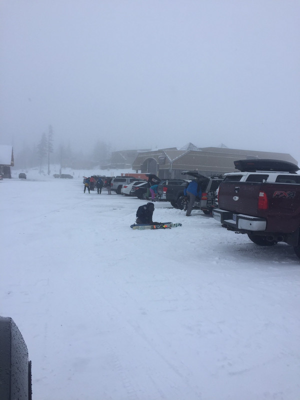
This pic was from Saturday at Bachelor that received about a foot between Thursday/Friday that allowed the resort to open up some additional terrain.
 picture share picture share
|
|
|
|
|
|
You'll get to see more forums and be part of the best ski club on the net.
You'll get to see more forums and be part of the best ski club on the net.
|
|
Storm in coming for the BC Coastal Range on Wednesday. Upper alpine should get close to a meter of snow over a 3 day period. Snow line might squeak up to about 1,100-1,300 meters are so for a brief period on Friday evening. That storm will slowly move down into the WA Cascades and then migrate further South into Oregon. Some of the storm energy will also transition East across the Coastal Range into interior BC as well as over the Cascades into Northern Idaho and Montana. Still looks like some low pressure activity off the Pacific that has a mind of its own, and slowly moving off the Pacific over the weekend. Weather models seem to indicate a small amount of precip and cooler temps for the weekend. The snow will be on the heavier side of the powder spectrum, as the say in these parts, Cascade Concrete. But the optimist refers to it as good base building material. And it is indeed!
|
|
|
|
|
|
|
|
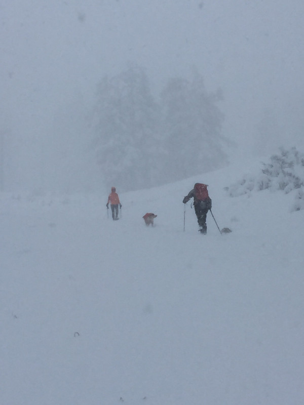
That is pretty much what happened in interior BC. Above Kamloops we had storms until Sunday, with 25 and 40 cms the days before that. The Airport was tricky and the highways were closed off and on. Since Sunday it's been mixed blue sky and cloud, with some flurries today (Thursday) and another system forecast. It has been a little heavier than usual for the interior. Slide risk is pretty high with a couple of dodgy layers in the snowpack, but face shots are still available. Temperatures around minus 14 today with some wind making it feel colder.
Here's a frame grab from today.

Burton Skeleton Key 154.
|
|
|
|
|
|
|
|